Transforming realitycapture data into accurate digital assets
Spatial Lab provides specialized point cloud, BIM, CAD and geospatial production services for surveying, engineering, architecture and infrastructure teams.
Point Clouds · Scan-to-BIM · CAD · GIS · Photogrammetry · Digital Twins
From raw survey data to production-ready deliverables
Spatial Lab transforms raw reality-capture and survey data into structured digital assets ready for engineering, design, construction and asset-management workflows.
We work as a flexible production partner for surveying, geospatial, engineering and AEC teams that need additional capacity without compromising accuracy or consistency.
Raw Data
Collect and organize multi-sensor survey data (point clouds, images, trajectories).
Processing
- Registration
- Georeferencing
- Classification
- Vector extraction
Process and enrich the data using proven workflows and automation.
QA / QC
- Geometric checks
- Attribute validation
- Consistency control
- Error reporting
Ensure data quality, accuracy and completeness.
Deliverables
- SHP / GPKG
- DXF / DGN
- Ortho / DSM / DTM
- Reports
Production-ready outputs delivered in the required format and structure.
What we are specialized for
Point Cloud Processing
Registration, cleaning, classification and noise reduction of terrestrial, mobile and aerial LiDAR point clouds, ready for modeling or GIS.
Scan-to-BIM & CAD Modeling
Point clouds and existing DWGs modeled into accurate BIM (Revit) or CAD assets — architecture, structure, MEP — at the LOD you specify.
Photogrammetry & Drone Mapping
Aerial and terrestrial imagery processed in Pix4D into orthomosaics, digital surface models and 3D meshes.
2D/3D Extraction & Topography
Topographic maps, DTM/DSM, contours and TIN surfaces extracted from point cloud or classic geodetic methods.
What we deliver
Capabilities in practice
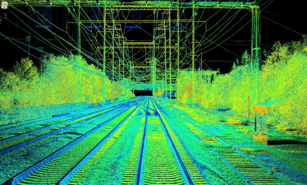 DEMO 01
LiDAR Classification & Terrain Model
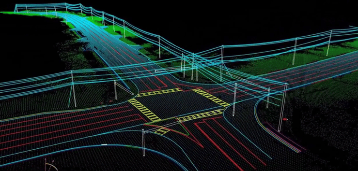 DEMO 02
Mobile Mapping to CAD
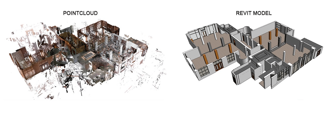 DEMO 03
Point Cloud to BIM
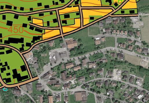 DEMO 04
Photogrammetry to 3D
Why Spatial Lab
Accuracy
Structured production workflows and careful QA/QC.
Flexibility
Support for both individual projects and recurring production.
Efficiency
Focused digital production without unnecessary overhead.
Interoperability
Deliverables prepared for common CAD, BIM and GIS workflows.
International Reach
Built to work across time zones, standards and delivery formats as flexible capacity for teams anywhere.
A small studio, built by people who've turned field data into digital assets.
Spatial Lab is run by people with hands-on geospatial and survey backgrounds — turning raw reality-capture data into deliverables engineering teams can actually build on, not just look at.
We work deliberately lean, taking on point cloud, BIM and GIS work directly rather than routing it through account managers. Fewer hand-offs, and someone who has actually touched your dataset on the other end of every message.
Comfortable working across time zones, software stacks and delivery formats as flexible capacity for teams anywhere.
Need extra production capacity?
Your team captures the data. Spatial Lab helps turn it into production-ready digital deliverables.
Whether you need additional capacity during peak workloads or a specialized production partner for recurring geospatial tasks, Spatial Lab can integrate into your existing workflow.
Let's discuss your next project
Tell us what data you have and what deliverable you need.